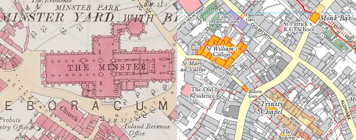
New for helping students to learn about the history of York: A History of York in Maps. In this G-drive folder you will find a history of York in several parts using the maps of the British Historic Towns Atlas Vol 5 on York. This brilliant interpretation with maps and a gazetteer was finally completed in 2015 and is part of the European historic towns atlas project that began shortly after the Second World War.
This History of York in maps is for students and teachers and it uses the maps to explain the development or York over time, from the arrival of the Romans in 71CE to modern times. Several themes are developed: political power, military power, religion, education, trade and industry.
The History is divided into parts:
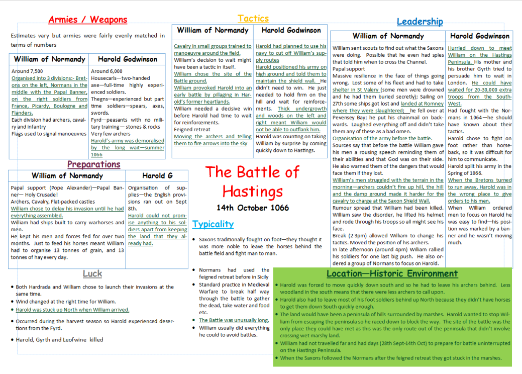
- Part 1: 71-1066
- Part 2: 1065-1200
- Part 3: 1200-1500
- Part 4: 1500-1688
- … More soon!!
(The format is .mov, and can be converted to mp4 using free online software if needed.)